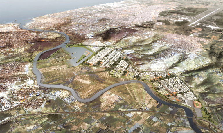
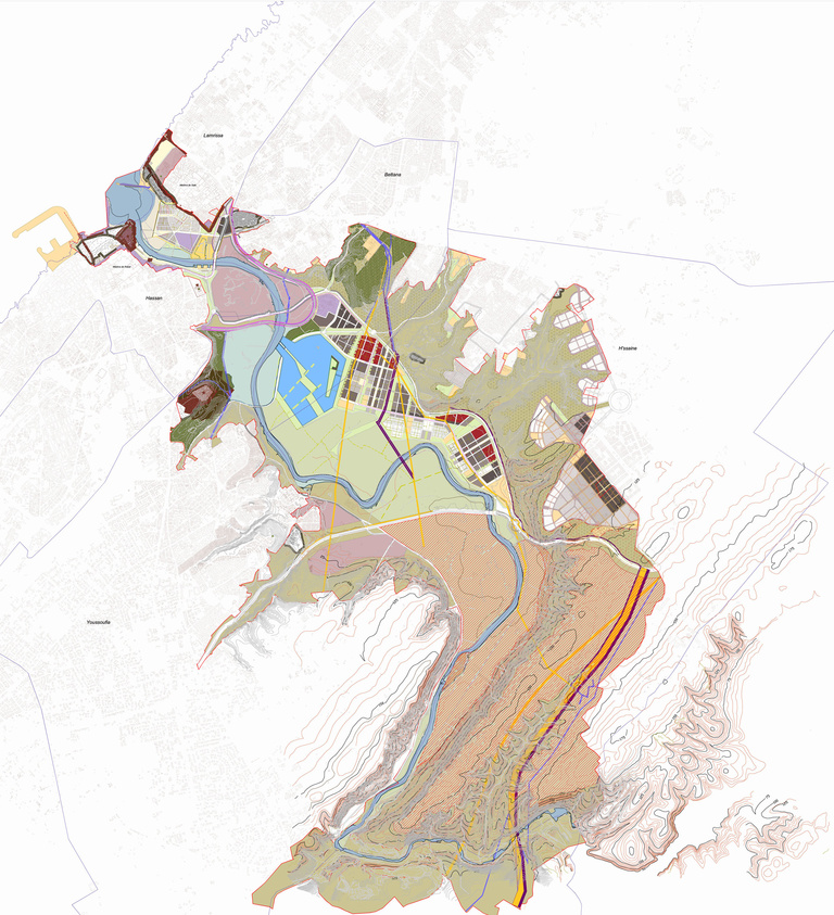
Between the ONCF Bridge and the Mohammed V Bridge, the Oued has created a broad flood plain covering 2,600 ha at the foot of the steep slopes of Salé.
The 500 hectares to be developed enter into another historical dialogue with protected area of the Chellah and with the major agricultural site of the Bouregreg Plain.
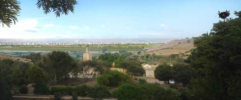
The Chellah complex is the foundation place of the Moroccan capital. The site, its natural environment and its horizons will eventually be recognised as a part of the World Cultural Heritage by UNESCO. The project for Sector 3 takes that dimension into account by locating the development at a distance from the Chellah (2.5 km).
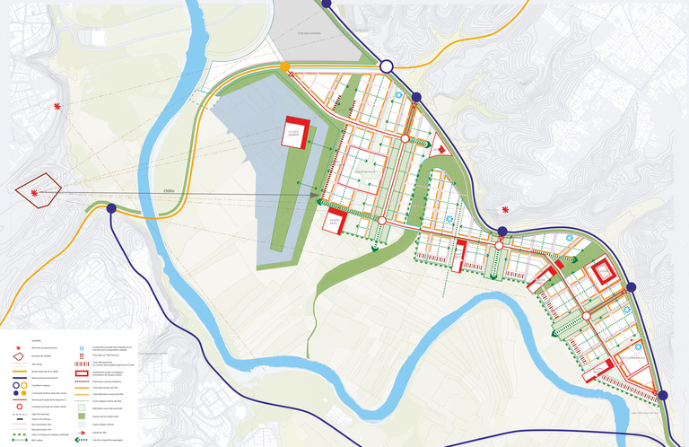
Beyond the river a lake connected to the general hydrology of the valley will provide the transition between the wetlands and agricultural areas and the development.
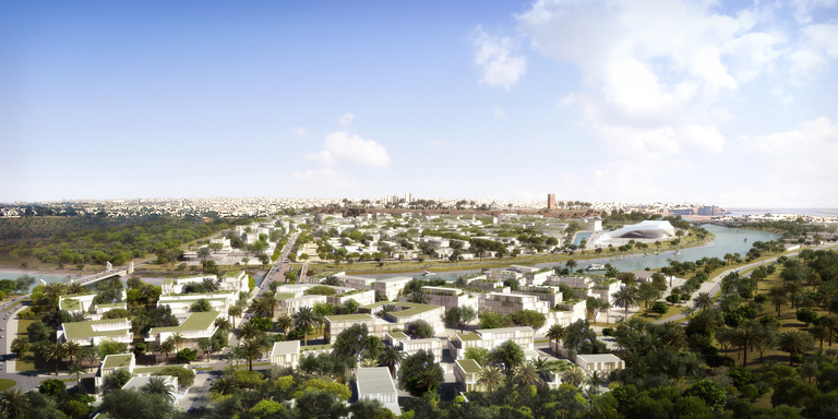
In this urban “foreground” a “Museum Island” will create a visual, cultural and historical connection with the Chellah. The symbol of the future city will echo the symbol of the ancient city.
The city is then broken down into four districts divided by large “hydrological corridors” which continue the talwegs of the hills.
The old potters' district is being redeveloped around its original function. It will be developed and amplified using all the Earth's resources, in the crafts practised as well as in the architecture.
The lake and museums district will be designed to be a major tourist hub extending the Chellah and the potters' village. This major urban hub will also be able to house major administrative functions on the main avenue of its structure, running from the hills to the river.
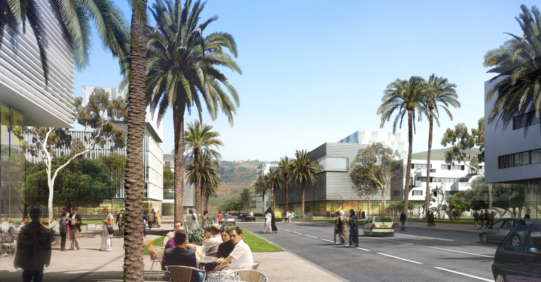
The central district in direct contact with the river will be home to tertiary and educational functions with a large residential zone open onto the river bank.
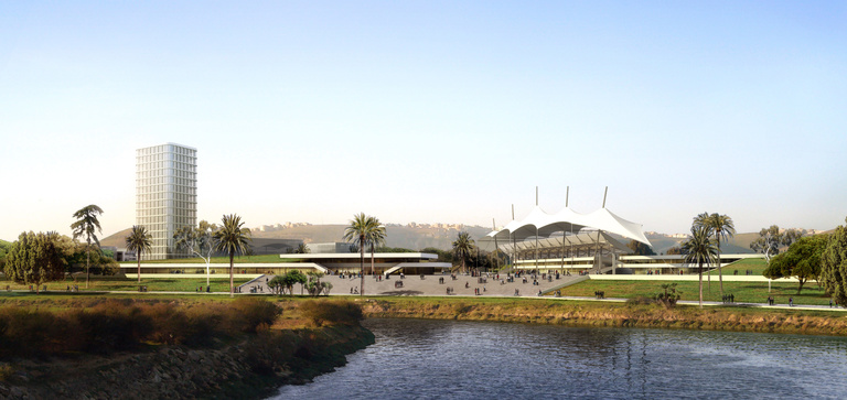
The southern district will be the true entrance to the valley from the bypass and the motorway. It will house public and private metropolitan functions: the Salé stadium, a shopping and leisure hub and a large non-residential complex. It is here that contemporary modernity will be able to be expressed – for example via construction of high-rise buildings.
These districts will be linked together by a large avenue and a tramway line running along Amwaj to the north and ending at the Lincoln roundabout and connecting to Line 1.
These districts take advantage of all the diverse geographical situations the right bank of the river offers. They open to the west toward the agricultural plain enclosed in the bends of the Bouregreg. This green space, a mix of agricultural park and urban park, will remain the “green lung” of Rabat and Salé in the future, just as can be seen today in the view from the Chellah or the Corniche of Rabat: it is an opening to the Earth as important as the opening toward the sea that is the estuary.
Major improvement work requiring several years will be necessary before this sector can be launched: building a hydraulic structure related to maintaining the navigation channel, backfilling of 380 ha of surfaces for urban development, construction of levees to protection against a 100-year flood event, deviation of the existing networks, installation of the main rainwater and wastewater collection networks, pre-greening, etc.